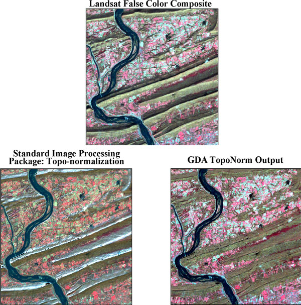
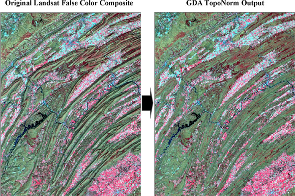
TopoNorm—Topographic Normalization of Satellite Imagery
“A Novel, Fully Automated Approach to Topographic Normalization which Simulates the Non-Lambertian Behavior of the Surface and Eliminates the Need for Minneart Constants”

Eliminate radiometric distortion of satellite imagery due to differential solar illumination of topographic slopes.
GDA’s TopoNorm technique:
- Provides superior results to traditional techniques such as band ratioing and image partitioning
- Eliminates the need for preconceived knowledge about the area, as methods based on Minneart constants require
- Fully Automated
- Requires image and DEM only!
- Maintains min/max, mean, and standard deviation values of the original image
- Tested on over 100 Landsat scenes for different regions of the world
TopoNorm vastly improves unsupervised and supervised classification results! Left untreated, differential solar illumination skews true spectral response properties of surface features. Therefore in areas of complex terrain, the unsupervised cluster classification analysis may produce too many classes while supervised techniques may result in the misclassification of land cover types.

